Wednesday, 22 February 2012

Scolty Hill & the Burnett Monument

Friday 17th February,

There was a certain amount of deja vue at the start of this walk. Last week we'd gone to Hill of Rowan so that we could visit a monument we had driven past many times. So this week we decided that, since Mo was still feeling good, we'd do the same again by climbing Scolty Hill and visiting the Burnett Monument. We'd tried this once before, on a Saturday, and hadn't been able to find a parking space in the car park! Being the anti-social pair that we are, we left and found somewhere less busy to visit.

Our goal for the day
We took the long way round to the start of the walk at Banchory so that I could photograph the goal for the day but we were still parked and booted by 10 o'clock. The car park this time was relatively quiet but I guess if we had been truly dedicated in our walking habits we would have parked in Banchory and walked from there. But let's face it if somebody's gone to the trouble of laying out and maintaining a car park it would be churlish not to use it.

Car park

The walk itself is, in the main, a typical forest walk along distinct and easy paths following the white waymarked trail, (well for most of the way anyway since we went walk about later). Once past the "planted" forest there's a steeper section up through some birch trees and a couple of very green holly trees. The path on this section was less well maintained but still very easy to follow. There's no navigation involved in this walk!


Easy paths

Holly(?)

Uphill and muddy

The steady uphill pull slowly opened up the views over Banchory and Deeside and although breezy it was a pleasant walk. The tower finally showed itself through the last of the trees and is set in an area cleared of heather. There's a tirg point and a couple of cairns with directions and distances of hills and other landmarks, (do these things have a proper name?). The only problem with this type of information is that the game of arguing over what you can see loses a bit the fun!


First glimpse

The Burnett Memorial

What are these things called?

Banchory and the river Dee

The tower is a memorial to General William Burnett an officer in the British army in the late 18th century. He served in France and in South America as well as the West Indies where he was Commander of Forces. When he retired he acquired the Banchory Lodge estate which included Scolty Hill. All of this information, and more, came from one of the information boards dotted around the woods and paths. The tower itself has been refurbished on a few occasions, the latest being in 1992 on its 150th anniversary. Unlike a lot of these types of towers this one is open to the public and has a modern, and secure, spiral stair inside so we duly climbed the 100 or so stairs to the viewing platform but the safety barrier around the top made taking photos almost impossible. It was also windy and cold so we didn't linger and decided that photos from the base would need to do.


Looking east

Towards Clachnaben

From the top we continued to follow the waymarked trails down and around the flank of the hill until we came to an unnarmed path that looked more interesting and decided that we'd go exploring, (or get lost as Mo suggested would be a better description). We spent a couple of very pleasant hours wandering along forest tracks, firstly down towards Banchory then back up towards the tower before coming across waymarks and heading back to the car park.


Exploring or lost?

Looking back towards the Tower

Unmarked forest trails

This was an easy walk along good trails and could be comfortably completed - up to the tower and back - in a couple of hours. There's no navigation involved and a decent pair of walking shoes would be more than adequate. There are other trails, some marked some not, that can be explored if you wanted to extend the day a bit.

J
More Photos

Tuesday, 14 February 2012

Cross Stone, Hill of Rowan, & St Drostan's Church

Saturday 11th February.

Friday was a wash out and despite the fact that we had said we would walk on Friday irrespective of the weather we decided to take the risk that the forecast was right and Saturday became our day of choice. Mo's health had been improving as the week went on so was up for coming with me, as long as it was achievable without the risk of over doing things. After some thought, and a quick skim through Walking Highlands, we decided it was time to visit the monument at Tarfside that we've driven past on numerous occasions on our way down Glen Esk, but had never investigated.

The walk starts at the public car park in Tarfside and when we arrived it was empty apart from a works van and the weather was promising with the early mist beginning to burn off.

Nearly empty car park

Water of Tarf

We crossed the Water of Tarf, past St Drostan's church, (we would visit this on our way back to the car), and headed up the grassy path towards the monument that topped the Hill of Rowan.

Today's goal

As usual we knew very little about Tarfside and its church or monument and as usual we vowed to do a bit more research on the places we were visiting before we set off. Of course we've said this in the past! The O&S map noted a couple of things along the route. There were "field systems" and "hut circles" but the locations are always too vague, and we're never sure what we're actually looking for, so I wasn't very hopeful. There was however an interesting note for a "cross stone" that looked to be quite close to the path, so we kept a close eye out for something that would fit the description. As it turned out we would probably have missed it if somebody hadn't marked the spot with a small cairn of white stones. The cross carved into the rock is well weathered but once you get your eye in it's fairly distinct.

Cross Stone
The stone is said to be associated with Saint Drostan who was a follower of Saint Columba. Legend has it that Robert the Bruce planted his standard on the stone prior to his battle with the Earl of Buchan in 1306. However it's also said that the stone was moved to its current location from somewhere else in the Glen in the 1800's. As with all of these legends I guess you believe the story you want to believe. Being a bit of a romantic, I like the Robert the Bruce story best! The Undiscovered Scotland webpage gives more detail if you're interested.

Looking back down the Glen

The walk up to the summit is a long slow pull and, apart from one or two places where it was slippery underfoot, was very pleasant. There was a wee bit of a steeper section where we left the path and made our way up through the heather to the monument. But Mo was comfortable enough and quite chuffed that we'd made it to the top.

Nearly there!

Hill of Rowan (380m)

The monument was erected by Maule Ramsay when he became the 11th Earl of Dalhousie and Baron Ramsey in 1866, (you can read a bit more about the man here if you're that way inclined). The building itself is empty apart from a broken iron gate and lot of rubble and some rubbish. There's an area of the wall that looks as if it may have had a plaque of some kind but now there's no information or even a name. Pity really.

Mount Keen

We sat for a while admiring the view and drinking coffee. The weather was very pleasant by now with blue skies and a gentle breeze. We played the usual game of trying to name the hills but it was straightforward today with Mount Keen and Mount Battock the two most obvious, so no disagreements. The route down took us to the road linking Tarfside to the Glen Esk car park and we had an easy stroll back towards the car.

St Drostan's Church

At the start of the walk we had passed St Drostan's Episcopal Church and the sign said it was open every day for visitors who may want to spend a few quiet moments in contemplation. For someone like me who has, despite my upbringing, become almost hostile towards religion, I still find churches fascinating places to visit, and St Drostan's wasn't a disappointment. Well maintained, it was bright, clean and functional with a beautiful timber roof and three stain glass panels up behind the alter. Well worth a visit if you're in the area.


From here it was a short walk back to the car. We had left just after ten o'clock and were back by two thirty, but we had taken it slowly and spent a fair bit of time at the monument so the walk could probably be completed in a couple of hours if you put your mind to it.

J

Tuesday, 7 February 2012

Glen Tanar to Little Cock Cairn Circuit

Friday 3rd February,

Sometimes when you head off into the hills the weather forecast promises you something special. Often you feel a little bit let down; the gentle breeze turns out to be gale force; the bit of high cloud is actually threatening thunderheads; and the occasional showers turn into torrential downpours. But not today. Today I was promised sunshine blue skies and no wind and it turned out even better than that.

Mo is still struggling with her health so I was again on my own and decided that, with the early start, I should consider getting some height under my boots for the first time in 2012. However I couldn't decide where, so to give myself options I decided to park in Glen Tanar. The advantages of Glen Tanar is that I was walking less than an hour after leaving home and if I was going to go high, (relatively), I had at least 2 hours of walking before I needed to make a final decision on what route I was going to take. According to the thermometer in the car it was (-)9C when I started walking at just after nine o'clock. The air felt fantastic and so cold it burned the hairs in your nose. It was enough to make me laugh out loud!

I won't bore you with the first hour or so because I've written about the northeast end of the Glen often enough, (Glen Tanar in the Snow and Glen Tanar & Bawdy Meg to name a couple), so I'll start with the first uphill pull through part of the lovely Caledonian Pine forest that the estate is trying to regenerate.

 First climb of the day

 Caledonian Pine Forest

This first part of the route is the same as the route to Clachan Yell and that summit was one of the options open to me. By now however I fancied the idea of going up onto Little Cock Cairn and maybe even Cock Cairn if time allowed. Not particularly high but high enough at this time of year. There were a couple of problems with this route though. Firstly it was quite a bit longer than I had anticipated and, with the short days, there wouldn't be time for any dawdling. Secondly there was the Water of Gairney to cross and although paddling in the summer months can be quite pleasant, at this time of year it was going to be a challenge!

First glimpse of Clachan Yell

 Looking back to the forest

The track up through the trees was pretty much free of snow but once clear of the trees it was covered, not deeply, but enough to make me cautious after my walking exploits in the snow last year. The skies were a perfect blue without a cloud in sight - literally. Days just don't get better than this.

A perfect blue

Decision time

Eventually I needed to make a decision about the route to take. I could carry on around the side of Clachan Yell and make my way down onto the Glen Tanar / Mount Keen path or turn left down over the Water of Gairney and on up to Little Cock Cairn. In the end I decided that I'd check out whether or not the river was crossable without getting my feet wet before making a final decision. As it turned out the ford where the track crosses at an angle was too deep and fast flowing to cross with my boots on and the weather too cold to go paddling.

Chequed

Rather than disappointed I felt a little bit irritated at being thwarted so I made my way upriver through the heather on the assumption that the river would get narrower. Finally after ten minutes of stumbling through the heather I came across a narrows that looked as if it could be jumped - mainly because I was jumping from the high side to the low side. The only problem was that I'm a 58 year-old fat bloke out on the hills on my own who has a vivid imagination of what it would be like stranded out here with a broken ankle! Of course it wasn't actually that big a jump but there was still a certain amount of satisfaction in getting to the other side with all my bones still intact.


Leap of faith

After battling back down river I rejoined the estate path and began the main uphill pull of the day. On the way I stopped for a few minutes beside an old friend of mine. Many many years ago I was walking this route in the opposite direction and photographed a knarled old pine tree and used it as my computer wallpaper for months. It was at a time when work was not going well and I used to look at the photograph and go there in my head for a while. It was amazing how dreaming of sitting under it would ease the stress and let me get my head straight before moving on with my day. Everybody should have somewhere to go when life gets too much. Unfortunately I can't find that original photo, but it'll turn up at some point.

An old friend

It may be that he was an old friend but it was way too cold to sit around under a tree and the day was getting on. The depth of snow steadily increased as I climbed and I began wondering how I was going to get back across the river if I was forced to turn back. Maybe I'd be paddling after all! However although it did take a bit longer than I had expected, and there were more false summits than I'd noticed when coming the other way, Little Cock Cairn summit cairn did eventually come into view.

Looking back to Glen Tanar

Towards Mount Keen

Mount Keen (r) Braid Cairn (l)

Little Cock Cairn (623m)

As I started down into the valley between Little Cock Cairn and Cock Cairn I decided that I'd feel more comfortable skirting the second summit. I was confident that I had enough time but I was also aware that if, for any reason, my way got blocked and I had to turn back then my timescales would change. Added to this is that although the O&S map shows a path up to Cock Cairn summit I was never able to find it in the summer so there was no chance of finding it today. It's one thing to slog your way through the heather in the summer but a lot less comfortable to do it in the snow. Well that's my excuse!

Cock Cairn

The final uphill pull took me around the side of Cock Cairn about 50 or 60 metres below the summit. The weather was still stunning and I sat for a while at a junction on the track for a late lunch and to admire the view down into Glen Tanar.

Long shadows

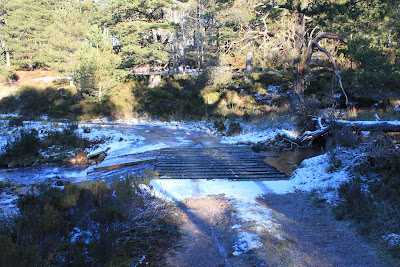
Since I'd crossed the river the only sign of life I'd seen was deer tracks but after about fifteen minutes of the decent I came across mountain bike tracks. It was obvious that whoever it was had struggled up this far before deciding that enough was enough and had turned back. I had to admire his, (or her), perseverance. It was bad enough walking in the snow, so what it was like cycling through it I can only imagine. After that there was little of note. I was disappointed to be coming downhill with the weather still so glorious, but an incident way back in a previous life when bagging Munros taught me that it was always better to walk off the hill an hour earlier than you wanted than an hour late. On that day we had left work in Inverness early one Friday in the middle of summer for Kintail and had climbed Carn Ghluasaid and Sgurr nan Conbhairean and were sitting at the top of the final hill, Sail Chaorainn, in time to watch the most beautiful sunset. Unfortunately we still had a two hour walk back over Sgurr nan Conbhairean to get off the hill. Even with head torches it doesn't rate as one of my fondest memories. Anyway we got off safely and I chalked it down to experience. No chance of that today though and after crossing one or two streams in spate I arrived at the ford across the Water of Allachy.


Glen Tanar plaque
Water of Allachy ford

Water of Allachy

Having reached this spot a little bit earlier than I expected, and now that I knew exactly how long it would take to get back to the car park, I decided to detour up to the lochan that Mo and I would use for our stopping off point if we were out for an afternoon stroll and I sat here and finished off the food and drink. The lochan was frozen so of course I looked around for stones to throw onto the ice. It took a minute or two before I began to wonder if it was weird for a grown man to throw stones onto a frozen loch when there were no kids around to give him the excuse. I'm still wondering, but it didn't stop me!

Frozen loch

The way home

Nearly full moon

I had left the car at just after nine o'clock with the temperature registering (-)9C and arrived back just before four o'clock with the temperature reading (-)3C. It had been one of the best walking days that I've had in recent years and if I could do all again next weekend then I would be a very happy man.

J
More Photos

Thursday, 19 January 2012

Glen Esk to the Stables of Lee

Friday 13th January,

After a wee bit of a blogging holiday over the festival period, we finally decided that we needed to get back into the routine of Friday walks. It’s not that we haven’t been out and about but it has tended to be snatching the odd walk from home or in other familiar places like Forvie with the dogs or a Christmas day walk in Glen Tannar. Now however it was time to start “proper” walks again, especially on a Friday. Unfortunately as Rabbie Burns once put it “the best laid plans ‘o mice and men gang aft agley”, and it turned out that Mo wasn’t feeling at her best so, being the loving husband that I am, I promptly left her at home and headed to Glen Esk. I had no particular plan in mind when I set out but with the weather forecast promising light winds and bright sunshine I was keen to try and capture the fantastic reflections that you can get on Loch Lee at this time of the year, but other than that it was a free day. Being on my own meant that I left home while it was still dark and had parked at the Glen Esk car park just after first light.

It's only a short walk from the car park to Loch Lee, passing Invermark Castle along the way. The castle was built around 1526 by the Lyndsays and if you fancy reading a bit about the history of it you can find it here.

Invermark Castle

Perched on the edge of the loch are the ruins of Glen Esk Old Parish Church, (the new church dating from 1803 stands near the car park), and is another of those ruins that I've photographed before and never really got the photo I wanted. This morning was no exception. But I tried anyway and had a walk around the graveyard as usual and wondered about the people buried there and their stories. Again if you want to know more then there's good information here.

Old Church Graveyard

Although the sun was getting up now there was also a fairly stiffish breeze and the surface of the loch was pretty well broken up. So no reflections yet it would seem. As I'd left the car park I'd spoken briefly to another walker who was also setting off heading for Hunt Hill and I was tempted to follow in his footsteps, but this was a hill that Mo and I had in our sights for later this year at some point so I finally decided that I'd just keep walking and see what, if anything, turned up!
The path along the loch is a well maintained estate access road and is easy walking. At the head of the loch sits the farm of Inchgrundle. It's one of these places that makes you wonder what it would be like to live there. Would it be the idyll that it looks or would it be a cold lonely place when the weather wasn't as beautiful as it was today. Who knows!

Inchgrundle

At the head of the loch there's a junction where one track goes off to the farm and the other heads off further up the Glen in the direction of Cairn Lick and it was this route that I decided to take. I had no intentions of going back up Cairn Lick but Hunt Hill was still available if things didn't work out. At the junction there's the dilapidated Glen Lee Cottage and I wonder why, when the rest of the estate is so well maintained, that they don't simply do away with it. Slowly but surely over the many years we've walked here we've watched it disintegrate. In the early days we even explored the interior, but now it's fenced off and looks decidedly dangerous. Maybe there's a plan, but somehow I don't think so.

Glen Lee Cottage

The track continues upstream following the course of the Water of Lee until it splits at the footbridge marking the route to the Falls of Unich and ultimately to the Falls of Damff. It's also the route to Cairn Lick and a possible route to Hunt Hill, so a decision was required!

Towards the Falls of Unich

In the end I decided to carry on along the path for two reasons. Firstly I thought there may be a better, (read easier), route up to Hunt Hill by coming at it from the North West and secondly I wanted to have a look at a building shown on the O&S map called the Stables of Lee which I assumed would be some sort of ruin for bygone days when mountain ponies would be stabled there for the benefit of helping the well-heeled get their trophies down from the hills. The weather, now that the sun was up, was very pleasant with almost no wind and a near perfect blue sky. I almost started feeling guilty about leaving Mo at home!


Ever improving weather

About half way between the Falls of Unich footbridge and the Stables of Lee there's a small plantation of trees, rather unimaginatively called Lee Plantation, with an old rather run down bothy, (or quaint depending if you're into bothies or not). Inside it was pretty obvious that there had been people staying there recently since I could still smell the fire and they had left a couple of unopened tins of soup and a couple of tins with no labels. On the inside of the roof people have left messages along with dates but I'm always a bit sceptical about whether or not they're genuine or if it's just somebody with a bit of a strange sense of humour.


Bothy


Are the dates believable?

Signs of recent habitation

Beyond the bothy the path climbs slowly but steadily towards the end of the Glen and I think when Mo and I finally get round to climbing Hunt Hill we'll come this far before crossing the river, (there's and estate footbridge just past the bothy), and making our way up from there. Before reaching the Stables I met a couple of estate workers clearing the drainage ditches across the track. Not bad work if you can get it on a day like today and, as one of the guys pointed out, at this time of year it's a short day! From my blether it was only a short distance to my goal at the Stables. To my pleasant surprise, and I don't know why I was surprised really, not only was the building not a ruin, but it had two ponies stabled in it. I can only assume that the deer carcases are still transported from the hills on the backs of these ponies.


Stables of Lee

One of two ponies in the stable

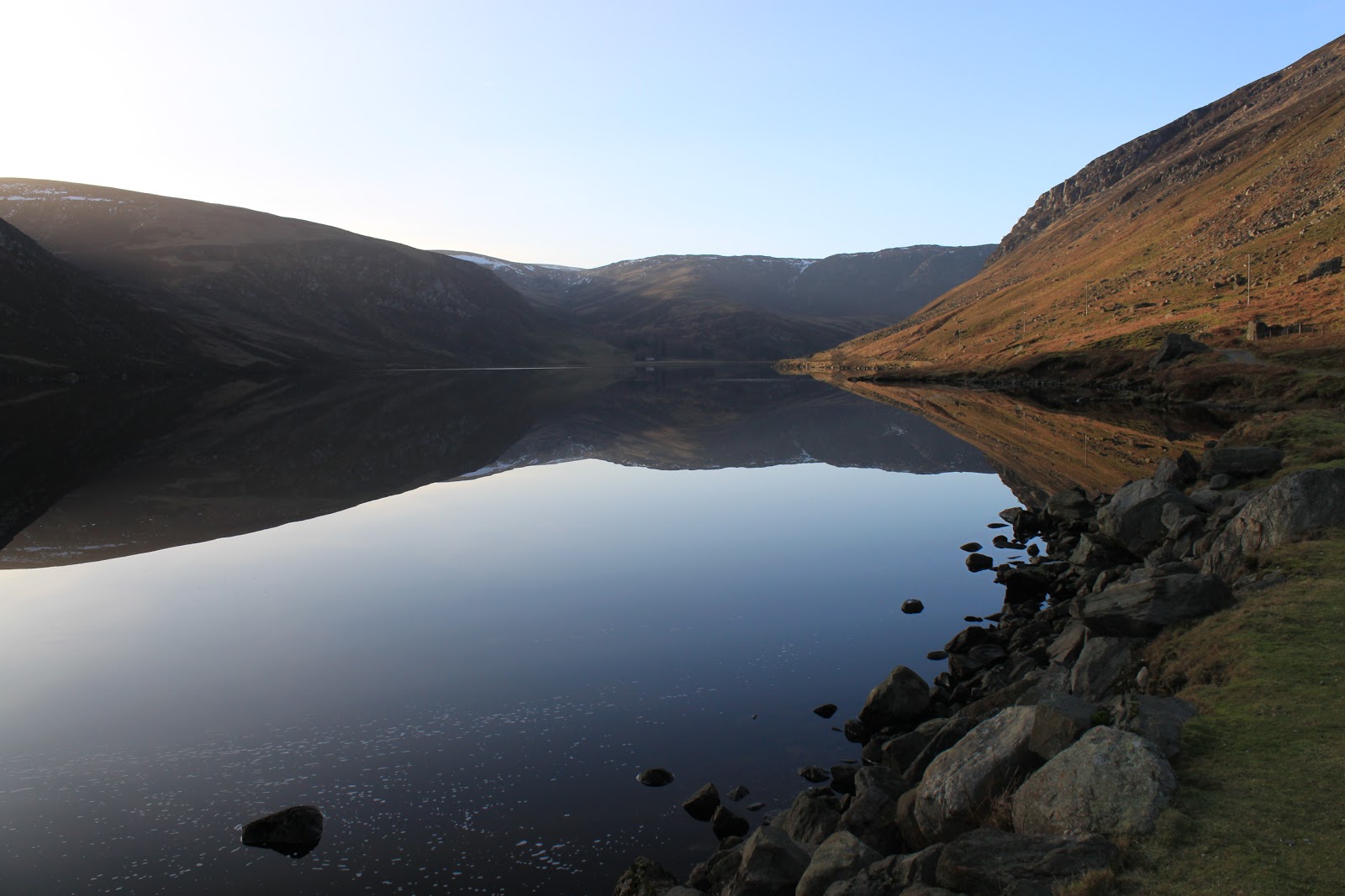
Having reached the end of my walk and had a bite to eat with my new equine friends I retraced my footsteps back to the loch where to my delight the wind had died down and the water was flat calm. With the sun up and blue skies I was able to get the photos I'd hope to get when I set of from home some five hours earlier.


Loch Lee Reflections 1

Loch Lee Reflections 2

Loch Lee Reflections 3

From here it's only a gentle stroll back to the car park. Apart from the walker I met at the start and the two estate workers I had the place to myself and never met or seen another person. I had started walking around eight thirty and wandered back just before three o'clock.

J