I think I should start with a wee bit of an explanation. A couple of years ago my brothers, (one older, one younger), decided that, since we lived in different areas of Scotland we needed a way to keep in touch other than the usual phone calls. So, since we all seemed to like the idea of taking photos, the The Murray Photo Challenge was born. In the couple of years it's been running we've taken turns about at choosing a subject for the month and we need to post a minimum of five photos on that subject. This month it was my turn so for Andrew in Edinburgh it was "An Urban River - The Water of Leith" for Robert in Galston it was "The River of our Childhood - The Burnawn" and for me in Aberdeen it was "Just for a Change - The Don not the Dee". I decided that, as well as taking photos of the Don in and around Aberdeen, it would also be quite good to combine the challenge with this week's walk by trying to get a photo of the source. The problem was that I had no idea where that might be! Still Bing Maps is the font of all such information and with a little patience I followed the river, electronically speaking, from Donmouth, along Strathdon and into the Cairngorms to a point just east of Cock Bridge. Unlike the Dee which starts, rather pretentiously I always felt, some 1200 metres up Braeriach at the Wells of Dee, the first mention of the Don is where two streams, the Allt Veannaich and the Allt Tuileach come together. The only downside appeared to be that it didn't seem very far from the Corgarff Castle car park.
So that's the background as to why I was setting off just before eight on a bright and breezy Friday to try and find the source of the River Don. Sounds a bit like the short version of David Livingstone setting off for Africa to look for the source of the Zambezi! Ironically I started the drive over by going down Deeside as far as Ballater then heading over the military road, (the A939), so I could photograph the old hump-backed bridge over the Gairn at Gairnshiel, something I should have done when we walked in to Corndavon Lodge a couple of weeks ago.
 Gairnshiel Bridge
There are some beautiful roads in Scotland, but the part of the A939 between Deeside and Strathdon has to rate up there with the best. After crossing the River Don for the first time today I joined the more notorious part of the A939, the infamous Cock Bridge to Tomintoul stretch, usually closed for most of the winter! No problems like that today though and I parked in the Corgarff Castle car park, feeling slightly guilty at taking advantage without visiting. I salved my conscience by checking the opening times and realised it wasn't open yet anyway.
 Corgarff Castle & Car Park
Despite Scotland's "Right to Roam" legislation it's amazing how intimidating a sign reading "private no entry" can still be and that's what confronted me. Still I told myself that it was aimed mainly at cars rather than walkers and boldly set off, feeling more like David Livingstone going off to confront the natives than ever. As it turned out I never met anyone, natives or otherwise for the most of the day.
 "Private, No Entry" Aye right!
The walk followed a well maintained tarmac road leading to, according to the map, Delnadamph Lodge. It was quite a strange walk in. On my right the youthful river Don wound its way in tight hairpin bends through lush reeds and grasses, yet on my left I had heather clad hills climbing sharply. I passed what looked like an empty holiday cottage before arriving at Delnadamph Lodge. After Corndavon Lodge I was expecting another grand granite structure so was pretty disappointed with the two storey cottage that I came across. There were a few outbuildings, one of which looked as if it may have been kennels or something similar, but the house was a disappointment.
 Delnadamph Lodge
 Kennels?
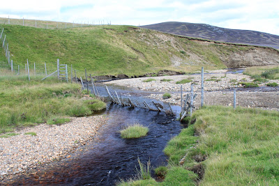
From the lodge I walked past another outbuilding that looked as if it had been refurbished to be a place for people to gather, possibly before setting out for a days shooting. From what I could see looking in the windows there was a large room with tables and chairs and a rudimentary cooking area. There were other rooms but I couldn't see into those. The track I was on would eventually cross the Allt Veannaich so I turned and walked downstream along its banks for a hundred yards or so until it met the Allt Tuileach and the resultant river became the Don.
 Veannaich + Tuileach = the Don
It was still early so I decided to follow the Allt Veannaich, being the larger of the two burns, for a while longer so retraced my steps back to the track and carried on. A bridge took the track to the other side and a crossroads. The track to the right led up to another bothy type building, (locked of course), straight on headed out into the hills and left continued to follow the burn, so this was the way I went. After a short walk I was a wee bit surprised to find the burn dammed and a reservoir behind. The Dam wall looked distinctly dodgy but I had a walk across the top of it anyway!
 Bridge over the Allt Veannaich
 Dam and Resevoir
 From the other side
 Nice spot!
I carried on for another mile or so, past where the burn split again before the track dropped down to cross the larger of the two then headed up into the high hills. I decided at this point that I'd head back to the locked bothy for lunch and a rest.
 Time for Lunch
From here I needed to decide on what to do about getting back to the car. The straightforward way was to retrace my steps but I knew that if I could get across either the Allt Tuileach or the fledgling Don I could pick up the path on the opposite side of the valley and make my way out that way. There was no obvious path between the two sides of the valley, so working on the theory that the Tuileach would be narrower than the Don I made my way along a faint track past a small lochan and a nursery for young grouse then down to the banks of the burn. It became pretty clear that the water was too deep to paddle and only just too wide to jump. However I had decided that I really didn't want to go back the way I'd come so, choosing a part of the bank that was higher on my side than on the other I jumped, landing with one foot in the shallows but managing to stay mainly dry.
 Leap of Faith!
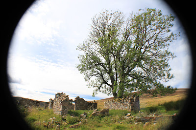
Once safely, albeit a little soggy, across the river I made my way up onto the north track and for the first time today came across what looked like the remains of a derelict cottage. After Glen Gairn, where there seemed to be ruins every half mile or so it was a surprise that I hadn't seen any at all on the south side of the river. Was this because of the Lodge and castle being on that side I wondered?
 First ruin of the day
The walk out from here was along an estate track past three estate houses that appeared to be still occupied at least some of the time. There had been a fair amount of tree clearing going on and I chatted to one of the JCB drivers collecting the remains of timber and branches into lots and lots of bonfire sized bundles. He explained that although they would normally leave this stuff to rot naturally the estate owners were keen to turn this part of the hill back to heather so the bundles were to be burned. I've got to say that I fancied being around for that spectacle!
 Bonfire Bundles
There are times when I walk in the hills and tracks and I come across things that make no sense. I know there will be a perfectly reasonable explanation, but it isn't always obvious. In this case it was a gate. Just an ordinary garden type gate. The problem however was that it was two feet off the ground at the top of the fence. It was tempting to believe that somebody had the drawing upside down but I know there is a proper reason someewhere, there has to be.
 Mind the step!
The weather by now was still very pleasant but the clouds were bubbling up so I hurried my way back to the main road stopping only to take a couple of photos of the Briggie Bothy, part of the Allargue Arms Hotel, and the river as it passes under the first of many bridges on its way to Aberdeen. The car park at Corgarff was still empty and I hadn't been clamped, which is always a relief!
 Corgarff Castle
I had left the car just after ten o'clock and wandered back around two thirty. It is was an interesting walk and a little different for me. Maybe next week though I'll try to get some height under my boots.
J
More Photos
I really like the idea of setting out with a purpose – in your case JC the source of the Don – rather than just walking a route for the enjoyment of it. I find I am doing this sort of thing more and more these days because it adds a bit of interest and takes you places you wouldn’t otherwise have gone. Can’t work out the gate, though. Unless there was a special offer on for small gates and the farmer bought a batch to save some money.
ReplyDeleteAlen McF
The gate is part of a (hopefully) rabbit proof fence - wire netting beneath it and also buried below ground level to deter burrowing.
ReplyDeleteThe lodge at Delnadamph was demolished in the late 80s - there's one or two pics of it on the Net. Your photo's are of the Mains Cottage and the dog kennels. The dam and reservoir provided the lodge's water.
The bothy was open until about 10 years ago when the problem of folk driving up the track for parties and using the furniture for firewood got a bit out of hand.
Rest assured - the "Private No Entry" sign is just for cars.
Thanks for looking in and the additional information it's really appreciated....J
DeleteNo worries and happy to help. You may need to come back - the Don really starts at the Well of Don, a mossy gloop just below the 700m contour between Little Geal Charn & Cairn Culchavie. Back to the Delanadamph dam and follow the track up its right hand side, ignoring all tracks splitting off to the left and climbing higher all the time. Eventually the track ends, strike out west to the obvious col (good views of Ben Avon), take the ridge right, following the new fence and up and over Little Geal Charn to descend to the source. It's all marked on the OS Landranger, sheet 36. It'll put some height under your boots but avoid the grouse and stalking seasons.
Delete