Friday 3rd August,
We decided we'd had enough of waymarked routes and river walks and lazy weekends so this week we we're going a proper walk into the hills. Glen Tanar has always been a favourite place for us, probably because it was one of the first places we explored with the kids when we moved through from Inverness. In those early days we stuck pretty much to the marked trails, but as time went on we explored further up the Glen to Clachan Yell and Cock Cairn and Baudy Meg. Today however we intended following one of the two drove roads that pass through Glen on their way to Glen Esk. The Fungle Road comes in from The Forest of Birse but our one, The Firmounth Road, runs the full length of the Glen and we've walked bits and pieces of it many times over the years.
 |
| I know I said no waymarked route, but you know what I mean! |
We're not going all the way into Glen Esk of course but intend making it into a circular route by turning away from the road around its highest point and going up and over the wonderfully named Hill of Cat, (the fact that there's a trig point at the summit is purely a coincidence - honest I'm not ticking them off!). We will then drop down the other side and pick up the route around Little Cock Cairn. From there we'll make it up as we go along depending on how we're feeling and what time of day it is. We parked at the Estate car park although we could have pick up the road back at the Aboyne entrance to the estate. But the car park's handy and a bit more convenient on the way back when we intend being tired. I've covered the first part of the walk in on many occasions but I still stopped to try and get that photograph of St Lesmo Chapel, but as ever I'm never happy with the result. Someday I'll get it right!
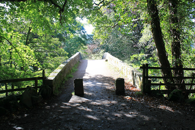 |
| We're off and the sun is shining. |
 |
| St Lesmo Chapel |
Throughout Glen Tanar there are random carvings made in the rocks by the side of the tracks. I don't mean ancient, prehistoric carvings, I mean just words, sayings or signs carved into rocks. Robert Smith in his guide book
25 Walks in Deeside explains that they were done by the eccentric 19th century laird, William Cunliffe Brooks or Wilcebe to his friends, (Will C.B. get it?). The initials can be seen around the estate with cryptic sayings or homilies for the passer-by. The first one is at the car park and we've found a few others over the years so I decided to photograph the ones we pass today.
 |
| Ceud Mile Failte - A Hundred Thousand Welcomes |
We pick up the drove road just past the Chapel and head up through the first of the remnants / re planted Scots Pine forest that once covered this area. There's evidence of people living in the area since the Bronze Age and some of the original forest survived until the First World War when 3,200,000 cubic feet of timber was felled in Glen Tanner. There was also a fire that burned for 12 days in 1920 that destroyed 1400 acres of what was left. Re-planting began in 1953 but fire it seems is a constant threat and a lot of this early work was destroyed in 1956. The drove road, an estate track at this point, climbs steadily and, about half way up this short climb, we pass our second marked stone.
 |
| Let Well Alone |
I don't know what it means or if it's trying to make a point and if it is then I'm afraid it's way too subtle for me. As the track levels out we pass a tall lone pine tree with a rusting iron fence surrounding it and just opposite this is the third stone of the day marking The Monk's Well. I read somewhere once that this spot marks the position of the first well on the drove road and that it was manned by a monk. It's as good a theory as any but I make no claim to it being true.
 |
| Lone Pine Tree complete with its own fence |
 |
| The Monk's Well. I think the numbers at the top are 8169 |
The track at this point is an undulating walk through trees that have grown a bit in the years we've been walking here. There was a time when we had fine, uninterrupted views around the Glen but now it was a steady slog until we came to "our" lochan, discovered by us early in our explorations, (actually we were lost, but exploration sounds better), of the Glen. A couple of hundred yards before the lochan is our next marked stone that sits at the Baudy Meg junction. Again I have no idea what it means.
 |
| The Baudy Meg junction complete with marker stone |
 |
| II 853 |
 |
| "Our" Lochan |
We sat by the lochan and, almost inevitably, ate chocolate and drank coffee. This seems to be becoming a theme of our walks. But it was still early so we didn't stay long. The track narrows here but it was still an easy climb up away from the lochan until we reached the fork in the track. A Sunday stroll would now take us down towards the river and back downstream to the car. But today we're drovers so it's the left hand track uphill and boggy, through some impressive old Scots Pines that have watched more than us wander past.
 |
| Right takes us home, left takes us up and out of the Glen |
 |
| A proper tree! |
The track was very wet at this point and a steady uphill pull, but it was still an easy enough walk. The pine trees are huge and impressive but they block out the view so we pass the time by wondering how long they've stood there and what they've seen, way back in the days when the world was in black and white. We passed a couple of big ant hills and I surprise myself by how much I want to dig into them to see how it was made up and to find out if the ants would just start again. Mo of course put a stop to that, murmuring under her breath that men just never grow up! Which is probably true. When we cleared the tree line we came out into a beautiful clear day so we stopped for a wee while to play the "name the hill" game!
 |
| Clearing the trees |
 |
| Clachan Yell |
 |
| Lochnagar |
 |
| Morven |
Well that was our best guesses anyway, but if you want to correct us please feel free! Clear of the trees we climbed steadily with the views and the weather improving as we gained height. I'm pretty sure that, although we're on the original route of the drove road, the hardy people who walked this route were not walking on a path anything like the estate track we're on, and my admiration for them is again reinforced. We really do have it easy. This part of the walk tops out at a cairn with battered old National Park information sign attached and a gate through a fence that no longer has any wire on it.
 |
| Seen better days |
 |
| The gate has survived better than the fence |
The track passed through the gate and followed the fence posts for a long flat walk heading for the gap between two hills called Hill of St Colm and Gannoch. We stopped for a while for more chocolate of course, but a bite to eat as well. We were a little bit behind the very loose schedule I had in my head but it was such a beautiful day that it seemed churlish to hurry too much. We dropped down into a little bit of a valley where the path became very marshy and we speculated as to whether this sheltered, lush area could have been a stopping off point for the drovers. It had taken us around three and half hours to get here from the car park so maybe, coming from Aboyne and driving beasts in front of them, they would have stopped off here. Or would they have carried on over the hill and down into Glen Esk? I guess we'll never know.
 |
| Not so nice walking |
 |
| Our path up and out of the bog is on the left |
We left the boggy area as we climbed up and away from the valley towards the pass. The path was much more of a hill track at this point, but itwas still a pleasant, not to steep walk up and over the pass. It became wet and boggy underfoot again as it leveled out and we started looking for St Colm's Well the position of which is shown on the O&S map. It turned out to be a little bit underwhelming although I wonder what I was expecting! It does however come with its own marked stone.
 |
| Well Beloved |
 |
| A little bit underwhelming I thought. |
The path remained wet and boggy making this long flat section a bit of a slog but we were cheered up by the first sight of our turning point at Hill of Cat. So far we had been walking away from the Glen but when we reached the top of the hill we would officially be on the way back, albeit via a different route.
 |
| Hill of Cat |
Before we started up the final climb however there were still a couple of marked stones to photograph. The first looked a bit like a classy piece of vandalism and the second a boundary stone perhaps. I'll let you decide.
 |
| WF or maybe E 1814 |
 |
| B for boundary perhaps or maybe Brooks |
The plan at this point was to leave the path as it made its way down to Glen Esk and cut directly up the hill and still following the fence posts. However this plan was a little bit dodgy because of the peat hags that the fence builders, being hardier than us, had simply ignored. So we were tempted by the glimpse of a new landrover track in the distance that appeared to have a branch heading in the general direction of the top. We decided to take the risk so continued on for another half mile or so past The Hill of Cat and onto the newly upgraded track.
 |
| Shiny new track and gate, (note the JCB in the distance) |
As luck would have it the track up towards the summit was still being built and only took us as far as the Burn of Keddloch. But they had bridged the burn and we joined the older, rougher track that was still a great deal drier than the one that ran alongside the old fence posts on the other side. This route took us past the JCB, (nobody working today), and steadily uphill until we picked up the old fence posts again above the peat hags where we turned and followed them to the summit.
 |
| Our first sight of the trig point |
 |
| Mo first to the top as ever |
 |
| Hill of Cat (742m). The cross on the top is actually part of an old fence post! |
I feel a little bit sorry for Hill of Cat. It's 742m high and a fair distance from any civilisation and yet makes none of the lists. Maybe we'll start another list called The Murrays for hills like this that are good fun but for whatever reason don't have any other classification. Then again maybe I won't and that way we'll get to keep it for ourselves. The path continued to follow the old fence posts over the top down the other side and it finally dawned on me that they are the same fence posts that I followed when I walked up to Cock Cairn many years ago. Just a little slow on the uptake!
 |
| The fence builders were still ignoring the peat hags |
 |
| The view into Glen Tanar and our route out |
The walk down following the fence posts was easy, apart from the occasional peat hag, and with the weather still beautiful it was a pleasant hour or so until we reached the estate track that goes up and over Little Cock Cairn. We were tempted to head uphill to the cairn but decided in the end that we had accomplished everything we had set out to do today so turned downhill back towards the Glen. The big advantage of this was that, as we lost height, we had some great views back to Hill of Cat.
 |
| Hill of Cat |
We sat for a while at the ford over the Water of Allachy once the downhill section was finished - my knees aren't what they used to be - and ate the last of the chocolate. We're very fortunate to live so close to such a beautiful spot and in the early evening sinlight the Glen was at its best.
 |
| Crossing the Water of Allachy |
 |
| It's a grand place to walk in any weather but in the sunlight it's at its best |
We had parked the car at half past eight and arrived back just before six o'clock on what had been a fantastic day both in the walk itself and some beautiful weather. But just to finish there are a couple of things I'd like to share. Firstly there's another marked stone on a different route that's quite nice.
 |
The Pine is King of Scottish Woods
And the Queen ah Who is She
The Fairest Form the Forest Kens
The Bonnie Birken Tree
|
And finally, that photograph of St Lesmo Chapel? I'm nearly happy with this one.
 |
| St Lesmo Chapel Glen Tanar |
J
More Photos


