Monday, 7 May 2012

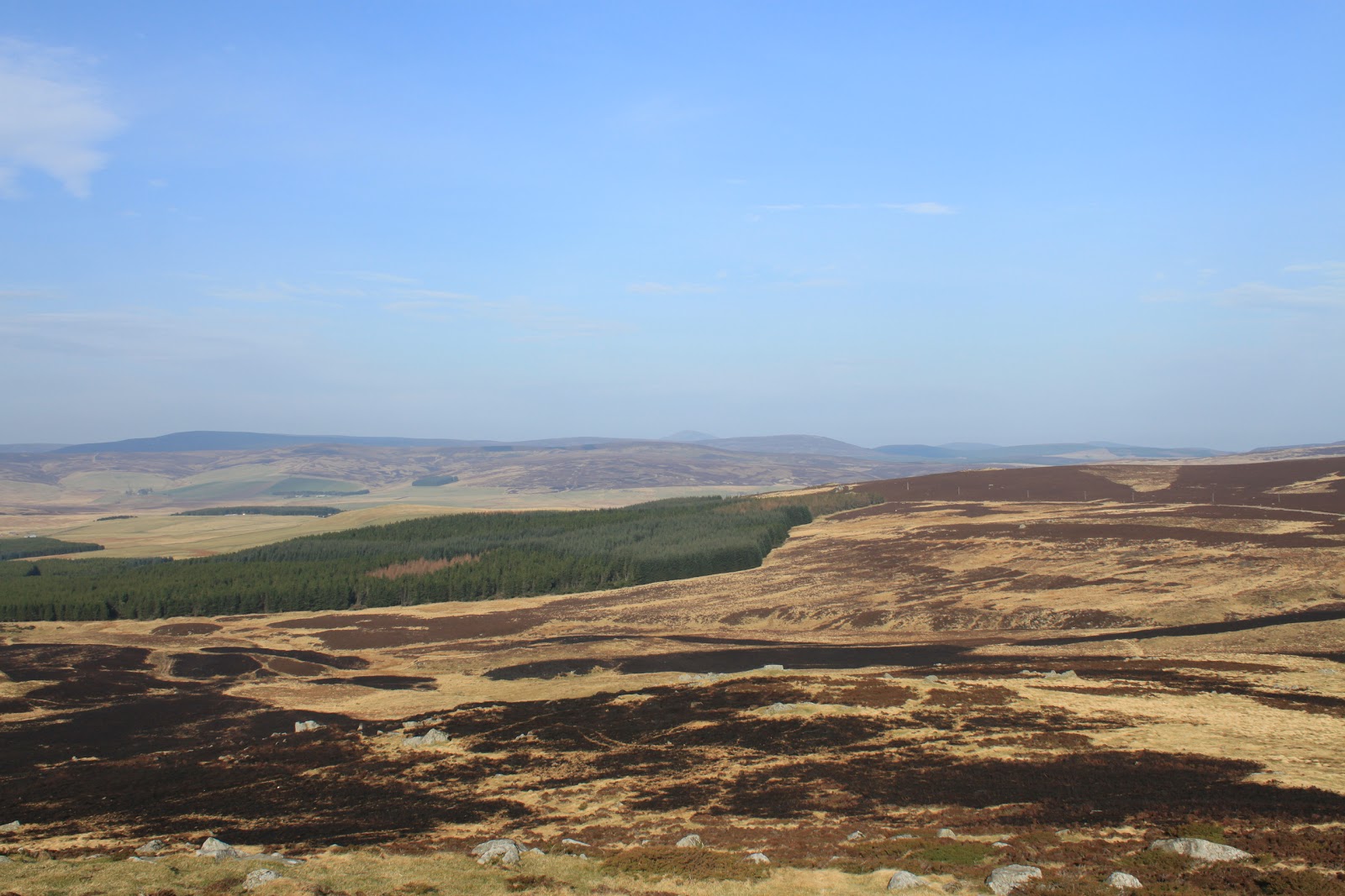
In Search of Balnamoon's Cave

Saturday 5th May,

After losing all of the April weekends to dog sitting at Cruden Bay and family visits back home we finally manged to get back into some sort of walking routine this weekend. Not that we had been idle at Cruden Bay - the dogs were well walked every day - but our outings were confined to the nature reserve at Forvie or the Slains Castle / Goat's Hillock circuit and, apart from sighting a couple of owls that seem to have taken up residence around the hill, there wasn't much to blog about. We did also manage a trip up Millstone Hill by Bennachie but since I'd also written that one up I wasn't inclined to repeat myself. I was tempted to write a post based on our successful search for the trig point at Forvie marked on the O&S map, but I decided that sounded a little bit too sad and desperate and that I wasn't quite at the stage of going through life ticking off trig points!

We had intended to walk on Friday but were put off by the strong northerly wind and driving sleet! I know we were being a bit namby pamby, but we're supposed to be doing this for pleasure after all! Saturday however dawned crisp and clear and although there was still a stiffish breeze it was much more inviting when we set off. The goal for today was to find Balnamoon's cave located somewhere at the north end of Glen Mark, something we had half heartedly tried to do last year when we only got as far as Queens Well. The walk starts at the Glen Esk car park that, being a Saturday rather than our normal Friday and being the easiest kicking off point for Munro baggers heading up Mount Keen, was relatively busy. Our route follows that of the baggers along an easy path for an hour or so until we reached Queens Well and since I'd already written a bit about this part of the route I thought I'd stick in some photos rather than more words!

Heading up Glen Mark

Our only view of a snow capped Mount Keen (right)

First sight of Queens Well with the Mount Keen path heading around Couternach

Built in memory of Queen Victoria who stopped off for a drink with Prince Albert in 1861.

Glenmark holiday cottage
We parted company with the Munro baggers at this point and continued to follow the Water of Mark upstream until the landrover track crosses it at a ford. It was at this point last year that we were thwarted and it didn't look a lot more inviting this time around.

Now what?
Looking at the photogragh it really doesn't look too bad but it would have been an uncomfortable crossing that would need to be repeated on the way back so, like last year, we headed up river on the assumption that it can only get narrower. We were obviously not the only people who had been a little bit frustrated at the lack of a crossing because there was a relatively well trodden path along the north bank. We stopped off for some coffee and chocolate and although this didn't help get us across the river, it did ease the frustration and we decided that we would continue to make our way along the riverbank until such times as it became impossible. If nothing else we wanted to reach the Burn of Doune waterfall that we could see in the distance, but that meant making our way along the steep heather clad hillside until we could reach the cropped grass at the base of the waterfall.

Craig of Doune

Looking back downriver - our route through the heather is on the left.
As it turned out there was a faint path that followed the very edge of the river and we reached the meadow at the foot of Craig of Doune without getting our feet wet. The Water of Doune waterfall looked a lot more spectacular from a distance than it did close up so, a little bit disappointed, we made our way on upstream. The theory being that if we could get far enough we might be able to see the cave from the north bank - disappointing but not a disaster!

Water of Doune waterfall
As it turned out the river narrowed as it passed through a steep sided gorge and rushed and tumbled over and around huge rocks. This then was decision time. It seemed a straight forward crossing at this point, the only difference being that falling in back at the ford meant getting wet, whereas now falling in would have much more serious consequences! However if nothing else this last year has taught us how to cross rivers safely, but I would suggest caution if trying to cross here during the winter!

Crossing Point
Once safely across we made our way up to join the south bank path. This was a wet, boggy area up and around the rapids and small waterfalls and it all looked quite picturesque as only this type of river can. Once around the shoulder we dropped down into a bowl like meadow with short cropped grass and, sheltered from the northerly wind, a very pleasant sun trap. Fortunately - and unlike us - we had done a little bit of research on our objective before we set off so we knew we were not looking for anything spectacular in the way of caves and it did take a bit of spotting, but jings if you need to hole up in a cave for a while this is where you'd want to be even if you might want to pick a better cave! The Laird of Balnamoon was a leading Jacobite who hid for many months after the fiasco at Culloden in 1746. Despite a substantial reward on offer he was never betrayed and eventually he was granted a reprieve and allowed to return to his estates near Brechin. So a happy ending I think.

Can you spot it? - It's right in the centre of the picture

You wouldn't want to be a fat fugitive!!
Not the most comfortable spot, (yes that is a flask but it wasn't ours and I'm pretty sure it didn't belong to Balnamoon!!).
But look at the view from the front door!
We had a very nice picnic lunch down by the river and without the wind it felt warm enough that it could actually have been May after all! While Mo did a bit of sun worshipping I climbed up the northern end of the bowl for a look at the last waterfall of the day and to photograph the area where the glen finally comes to an end. We were in a truly remarkable place.

Sun Worshipping

White's Pool
Our last waterfall of the day

Towards the head of the glen
The last thing worth mentioning at this point was seeing a bird I'd never seen before. Now don't misunderstand me I'm no bird watcher but generally when we're walking the birds look familiar, I don't always know their names but I do know I've seen them before. But this time I knew I'd never seen this one before so it took a bit of patience going through the RSPB website until I came across the Ring Ouzel, a blackbird sized bird with a distinctive white bib on its breast.

The Ring Ouzel, (photo curtesy of the Shropshire Birder)
 Finally, tearing ourselves away from the perfect spot, we retraced our steps back down the glen and crossing the river at the same point as before. The only difference on the way back was that we found a path much higher up in the heather that was easier walking than along the rivers edge but other than that it was a pleasant walk and, with the wind now at our backs, we made excellent time.

We had left the car at 09.30 and wandered back to the car park just before 4 o'clock. All in all a fine day.
John
More photos

Friday, 30 March 2012

The Buck of Cabrach (and The Tap 'o Noth to fill in the day!)

Sunday 25th March,

After no posts for a couple of weeks this is the second of this weekend! The weather left me with no real choice and after a quick battle with my conscience, (the garden needs tidying up and I should have been cutting the grass), I set off up Donside towards Alford. Mo had decided that after Friday's walk she would prefer a quieter day probably in the garden so this gave me the opportunity to get a bit of height under my boots. Although the weather was lovely there was still a bit of sea har near the coast this early and although I was sure it would burn off later, I headed inland towards the blue skies. My thoughts turned to a hill we'd driven past in the days when we travelled back and forth to Inverness more regularly and fancied a trip through the hills rather than the shorter but less interesting A90. The Buck of Cabrach, (a great name if you say it out loud in a thick Scottish accent), is a conical shaped hill that can be picked out from most of the high points on Deeside and Donside, (for "baggers" it's also Graham number 63) and the most popular approach is from the B9002 a couple of hundred yards from where it joins the A941.

The Buck
On my way!
Now as walkers we've all made mistakes. You know the kind of thing; you get to the top and realise it's going to be dark by the time you get down and you never thought to pack the head torch; or you run out of water on the hottest day of the year; or, worst of all you get to the top and realise you've left the sandwiches in the car!. Well the mistake I made today was that as I stood on the little hill just off the road called Meikle Cairn, (I'd wandered up here to get some photos), I realised that the walk up to the summit of The Buck wasn't going to take very long! The thought of being back home in time to cut the grass wasn't pleasant.

The Buck from Meikle Cairn
Well there wasn't much I could do about it except take my time so I set off back down to pick up the faint track that headed across the peat bogs towards the start of the uphill section. This track quickly turned into a quagmire of peat and moss and I found myself walking through knee deep heather in an effort to stay dry. Anybody reading this that fancies following this route I recommend making your way across to the line of fence posts that run all the way up to the summit as soon as you can. The path is heading there anyway but it's easier walking if you cut across early as I found out on the way back. As the path starts its way uphill it quickly dries out and it's a comfortable climb with good views on either side.

Looking North East

Tap 'o Noth and the beginnings of an idea
It was as I stopped to look around and take some photos that I began to think that, if I was finished early, I could maybe add in another hill rather than go home and cut the grass. Tap 'o Noth is a hill with a the remains of an iron age fort on the top that Mo and I climbed at this time last year and since it was only fifteen minutes in the car from where I was parked I decided that I'd head there after The Buck. Having made the decision I set off with fresh resolve ot the large summit cairn.

Nearly there!

The Buck of Cabrach (721m)

Great views from the top
It had only taken about an hour and a half from leaving the car to sitting having a bite to eat at the top, so not a long walk by any means. I also know that somewhere on the top there is a rock with carvings but, as usual since I'd done almost no research, I didn't know where to look. As the photos show there are a lot of rocks on the cairn! Anyway I had a look about but decided in the end that I'd be better prepared when I came back with Mo in the summer. I retraced my steps back down, this time following the fence posts a little further towards the road before cutting across to the waterlogged track and the short stroll back to the car. In all it had taken me just over two hours up and back with a stop at the top.

Tap 'o Noth,

I decided to have the rest of my food at the car park before heading off; it was nearly lunchtime after all. The car park was busy since it's an obvious short walk relatively near civilisation and with a good track right to the top.

Tap 'o Noth
There are in fact two routes up. The most popular follows an estate road that sweeps its way up and around, following the contours of the hill. The other is a more direct path through the heather crossing the estate path near the top and heading directly for the summit. With a couple of families in the distance making their way slowly up the track I decided on the more direct path. Call me anti-social if you like!

The steeper of the two routes

Crossing the estate track
The last 50m or so is a little bit of a scramble over the vitrified rock of the old fort before I dropped down into the bowl of the summit. A quick internet search threw up this history of where I was now sitting:

"The Iron Age hillfort on Tap O' Noth is one of the largest in Scotland, consisting of 21 ha enclosed by a stone rampart. More than 100 house platforms have been recorded between the rampart and a massive wall that further protects the hill's summit. This stone and timber wall, more than 6m in width and 3m high, is vitrified in places - the stones have fused together through intense, prolonged heat. The extremely high temperatures generated by the burning timbers causes the surrounding stone to melt, and this phenomenon has been observed at many forts. On the summit there is a rock cut well or cistern."   Cabmore

Whatever it was and whatever happened to it I can only take the writer's word for it but what I can say is that it's a very pleasant spot for lying in the sun for an hour until those families I mentioned earlier finally turned up!


Vitrified walls

Tap 'o Noth summit (563m)

Looking back to The Buck from Tap 'o Noth
I took the easy estate track back down and tried to be sociable to the several groups making their way up. The weather had stayed beautiful all the time I had been out although the haze hadn't done my photos any favours - at least that's my excuse! The views from both tops had been fantastic and I was glad to have decided to do both.

On the way down
In the end I was back at the car just after 2 o'clock, so not a long day even though I felt I had achieved a fair amount. And for the record I cut the grass on Tuesday!!

J
More Photos

Monday, 26 March 2012

Aboyne to Mortlich Circuit

Friday 23rd March,

It's been a couple of weeks since my last post. No reason really, just that we've had other commitments and we haven't been anywhere new. So today, with Mo's health in quite a good place and the weather set fair, we decided to try a walk listed on the Walkhighland website. I guess the only problem with the description on the website was that it suggested that it was maybe a little more testing than it turned out to be. We managed a reasonably early start and, since Aboyne is in lower Deeside and therefore a fairly short drive, we were able to set off from the square in Aboyne around 9.30. The start of the walk takes in the golf course which borders Aboyne loch and with it being relatively early and the temperature still low the light was quite atmospheric.


Aboyne Golf Course

Aboyne Loch
Golfers at Aboyne are obviously not early starters because we had the course to ourselves as we made our way across a couple of fairways to the lochside path which we followed for a short distance before picking up a detour from the long distance walking route, The Deeside Way, and starting uphill for the first time today through the remnants of an old birchwood.


Birchwood
It was easy walking on a good path and the temperature was rising with every minute that passed with only a fairly brisk wind in exposed places to remind us that we were still in March! We passed through a kissing gate, (at least that's what I'm reliably informed they're called), before breaking out of the trees and getting a view of the tree clad hill for the day.


Kissing Gate (?)

Mortlich
We passed through another couple of kissing gates as the path meandered gently towards the main uphill section. We were walking "against" the Deeside Way arrows along the way but the marker posts and weather meant that there was no navigation involved today, (always a relief for Mo, but I've never understood why. As I've said many times in the past: we're never lost, we're only exploring). Anyway we decided to stop for coffee and chocolate at the next gate which, coincidentally, was at the start of the main uphill section of the day.

Coffee Time

Start of the uphill slog

Q) What's the definition of Scotland in March?
A) A woolly hat and sunglasses!!
Suitably replenished we headed up what turned out to be a relatively steep but short climb through the trees with only limited views back down towards Deeside. The summit cairn is a large bundle of rocks with the remnants of a metal cross on top. As usual we hadn't done any research prior to climbing the hill and although we knew there was a cross there, (the Walkhighland reviewer had mentioned it), we knew little of its history. From what I've been able to find out the cross used to sit proudly on top of the cairn at the end of a long pole that had been concreted in. The pole was still there, but lying down and there was no sign of any concrete! There was however a stone plinth with a bit of the history carved into its surface.

First look at the summit (381m)

Now you know as much about it as I do!!

Cross and pole - not much left!
We decided to use the stone plinth as seat while we decided what to do about lunch and it was while we were sitting there that I got to wondering about what it actually said. Here was a cairn built in memory of some probably rich absentee landlord, by his probably still rich widow and the probably not rich "tenantry of Aboyne" and the left leaning liberal in me wondered just how much say the said "tenantry of Aboyne" had in the erecting of the memorial. Of course I may be doing the man an injustice; he may well have been a great man who held the "tenantry of Aboyne" close to his heart. I duly Googled him and Wikipedia suggests that maybe I was right to be sceptical! We decided to move off of the top to have our lunch before making our way back down to where we had stopped for coffee earlier. From there we picked up the Deeside Way markers and enjoyed a pleasant walk along the side of Morlich with some great - albeit hazy - views along Deeside.

Towards Deeside

Glorious weather but not for photos!
The plan from here was to follow the Deeside Way markers down to pick up the line of the old Deeside railway line and follow that back to Aboyne loch but after passing through yet another kissing gate we took a bit of a detour. There was no reason for this really other than the sight of an old bird trap by the side of a track leading up to a wee hill called Little Hill, (honest check Bing Maps if you don't believe me!). Anyway I wanted to have a proper look at the bird trap because although you see lots of them dotted about the hills they're never normally accessible, so I went up for a quick look. There was nothing interesting to see but now that we were part way up it seemed sensible to carry on to the top.

The summit of Little Hill (266m)

The old bird trap - and a couple of trees straight from Lord of the Rings!!
From the summit of Little Hill it was an easy walk down a grassy path towards the North Deeside road, (A93), but just before we reached it we turned into an avenue of Silver Birch and onto the route of the old Deeside railway. There's not much left of anything to do with the railway apart from the fact that it's arrow straight and passes through a couple of shallow cuttings. It also passes through Rosehill Croft. Now maybe I'm being paranoid, but we were left with the impression that we were not entirely welcome!

Avenue of Silver Birch

Rosehill Croft - not the warmest welcome perhaps
Once we cleared the croft we cut along in front of the Lodge on the Loch to pick up the path around Aboyne Loch then across a still empty golf course and back to the car. It had been an easier, and shorter, walk than we had anticipated even taking into account our diversion up Little Hill. We were back at the car by 14.30 and were left wondering if there wasn't something else we could have done. Never the less it had been a good day out and was another new walk that we will probably do again at some point.

J
More Photos